
Sinkyone Wilderness State Park
What’s Sinkyone Wilderness State Park like? Think Big Sur, but without the people or roads or anything, really. This section of California’s magnificent coastline is one of the most remote parts of America — a place where the mountains plunge into the Pacific’s relentless surf. The ocean here is hypnotic. It can be like staring into the eyes of someone you love.

ABOVE: The view from the Lost Coast Trail in Sinkyone Wilderness State Park. There’s something about the relentless rage of the surf, especially along the rugged coastline of Northern California. It’s the sweetest sound to fall asleep to in all the world.
The Lost Coast Trail

ABOVE: The Lost Coast Trail in Sinkyone Wilderness State Park is a good place to disappear for a while. You’re unlikely to encounter much of anything besides herds of Roosevelt Elk. Keep your distance — they can be mean.

ABOVE: Anderson Camp, five miles or so from the trailhead, is the first real opportunity to pitch a tent. While there are no ocean views like some of the camps further up the trail, there’s an eerie solitude that rolls in along with the fog.


ABOVE: The moon rises over Sinkyone Wilderness, one of the most remote areas in California and the United States. It is a land literally forsaken by humans, as plans to build Route 1 through this rough country had to be abandoned due to the severity and instability of the terrain. To find the spot you see here, you must drive a desolate, serpentine stretch of coastal highway with only a small town or two appearing out of the fog as you travel north. Then, if you can find the turnoff (it’s a tricky one), the next leg of the journey is six miles of sometimes washed-out and rutted gravel road up and down a mountain range. Here, you’ll find the trailhead, where you will depart on a trek that takes you a thousand feet up and a thousand feet down over and over again as you traverse steep, coastal terrain. After five miles or so — just a short hike into this wilderness, really — you’ll end up here, in a deep gulch with the forest rising hundreds of feet on each side, separated from civilization by several more gulches just like it. Though you won’t be able to see the ocean, you will hear the distant boom of waves intermixed with the rush of the creek below. Your back and legs will be tired, but soon the fog will glide in like a friendly ghost, the sun will dip into the dark and you’ll be alone with the gods in your very own Moonrise Kingdom.

ABOVE: Anderson Creek was my source of water and life in the backcountry. The rush of the stream, which was just down the hill from camp, was a lovely sound to fall asleep to, especially in symphony with waves booming in the distance.
Usal Beach

ABOVE: Usal Beach is the southern terminus of the famous Lost Coast Trail. Here you’ll find a remote campground with most of the signage sporting bullet holes. A bit forgotten and forsaken, this rugged section of the LCT in Sinkyone Wilderness State Park is nowhere near as popular as the northern stretch through the King Range Conservation Area. But you can indeed hike all the way to Mattole Beach from here — a trek of about 52 miles. Just be warned that in addition to being a little overgrown and hard to follow in places, this section of trail is brutal on the body. You’ll be going a thousand feet up, then a thousand feet down over and over again for 22.1 miles. But the reward will be magnificent — blissful solitude along the most wild and remote section of California’s great coast.
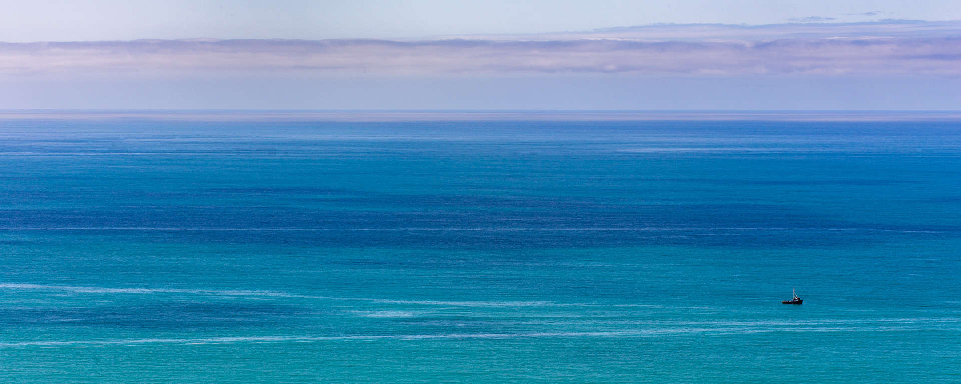
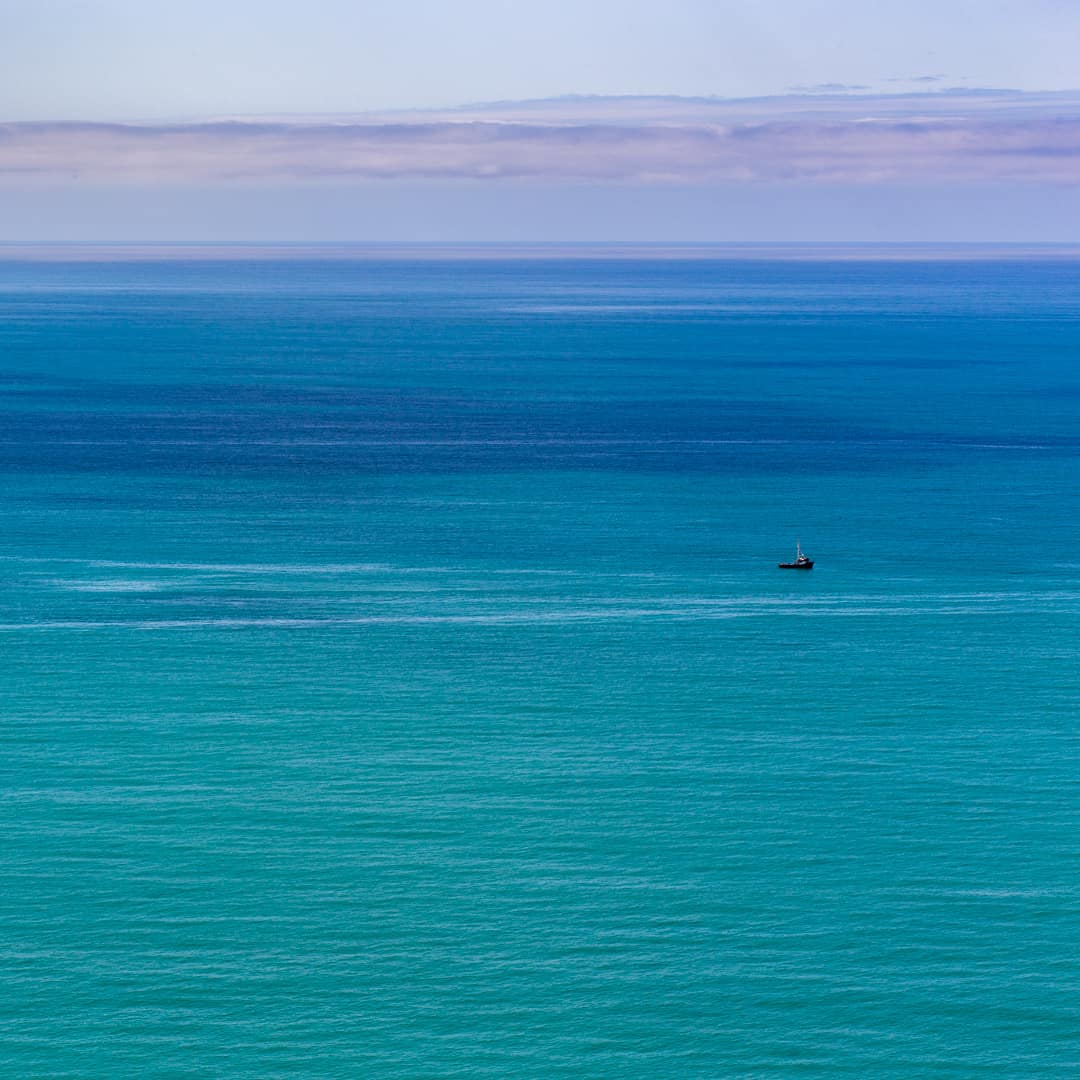
A Brilliant Blue Sea


ABOVE: A lonely fishing boat chugs through the vibrant seas off Mendocino’s Lost Coast, as seen from Sinkyone Wilderness State Park. I suspect there were quite a few more boats dotting the water in the days before the fish stocks took a dive. The color of the ocean here is something that will stay with me forever. Often when I’m stressed, I close my eyes and try to imagine it, along with the crashing waves and the cool breeze rushing through the redwoods.
Coastal Wildflowers

ABOVE: A California poppy, the state flower, blooms along the Lost Coast Trail.
A Coastal Forest


ABOVE: Fog begins to roll in and work its way up Anderson Gulch. It can occur on the Lost Coast anytime of year — especially in the summer.
The Lost Coast Trail
The Lost Coast Trail in Sinkyone Wilderness State Park is a good place to disappear for a while. You’re unlikely to encounter much of anything besides herds of Roosevelt Elk. Keep your distance — they can be mean.
Anderson Camp, five miles or so from the trailhead, is the first real opportunity to pitch a tent. While there are no ocean views like some of the camps further up the trail, there’s an eerie solitude that rolls in along with the fog.
The moon rises over Sinkyone Wilderness, one of the most remote areas in California and the United States. It is a land literally forsaken by humans, as plans to build Route 1 through this rough country had to be abandoned due to the severity and instability of the terrain. To find the spot you see here, you must drive a desolate, serpentine stretch of coastal highway with only a small town or two appearing out of the fog as you travel north. Then, if you can find the turnoff (it’s a tricky one), the next leg of the journey is six miles of sometimes washed-out and rutted gravel road up and down a mountain range. Here, you’ll find the trailhead, where you will depart on a trek that takes you a thousand feet up and a thousand feet down over and over again as you traverse steep, coastal terrain. After five miles or so — just a short hike into this wilderness, really — you’ll end up here, in a deep gulch with the forest rising hundreds of feet on each side, separated from civilization by several more gulches just like it. Though you won’t be able to see the ocean, you will hear the distant boom of waves intermixed with the rush of the creek below. Your back and legs will be tired, but soon the fog will glide in like a friendly ghost, the sun will dip into the dark and you’ll be alone with the gods in your very own Moonrise Kingdom.
Usal Beach
A Brilliant Blue Sea
Coastal Wildflowers
A California poppy, the state flower, blooms along the Lost Coast Trail.
A pretty stand of trees in the forest near Usal Beach.
Fog begins to roll in and work its way up Anderson Gulch. It can occur on the Lost Coast anytime of year — especially in the summer.
Directions to Sinkyone Wilderness State Park
Related Organizations

California State Coastal Conservancy
Save the Redwoods League
Since 1918, Save the Redwoods League has protected and restored California redwood forests and connected people with their peace and beauty so these wonders of the natural world flourish. They purchase redwood forests and the surrounding lands needed to nurture them; regenerate logged forests so they become spectacular havens for future generations; study how to best protect and restore these global treasures; and introduce people to these magical places.

The Trust for Public Land
California State Parks
The mission of California State Parks is to provide for the health, inspiration and education of the people of California by helping to preserve the state's extraordinary biological diversity, protecting its most valued natural and cultural resources, and creating opportunities for high-quality outdoor recreation.